Refining Insights through Expert Point Cloud (LAZ/LAS) Classification.
Delve into the intricate details of your spatial data with our Point Cloud Classification Services. Geo Zone Technologies brings precision to the next level, providing advanced categorization for robust analysis and visualization.
Our Services
Delve into the intricate details of your spatial data
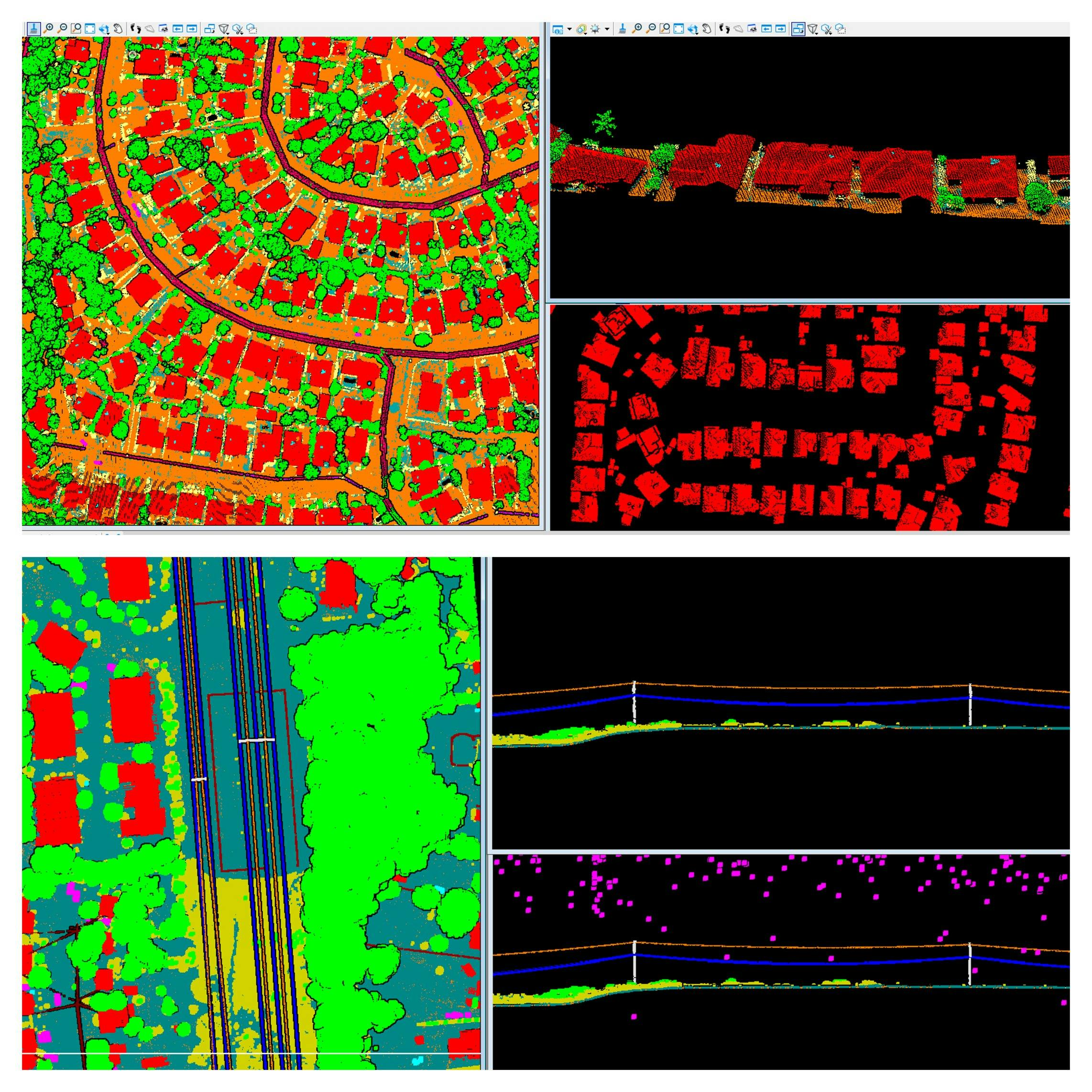
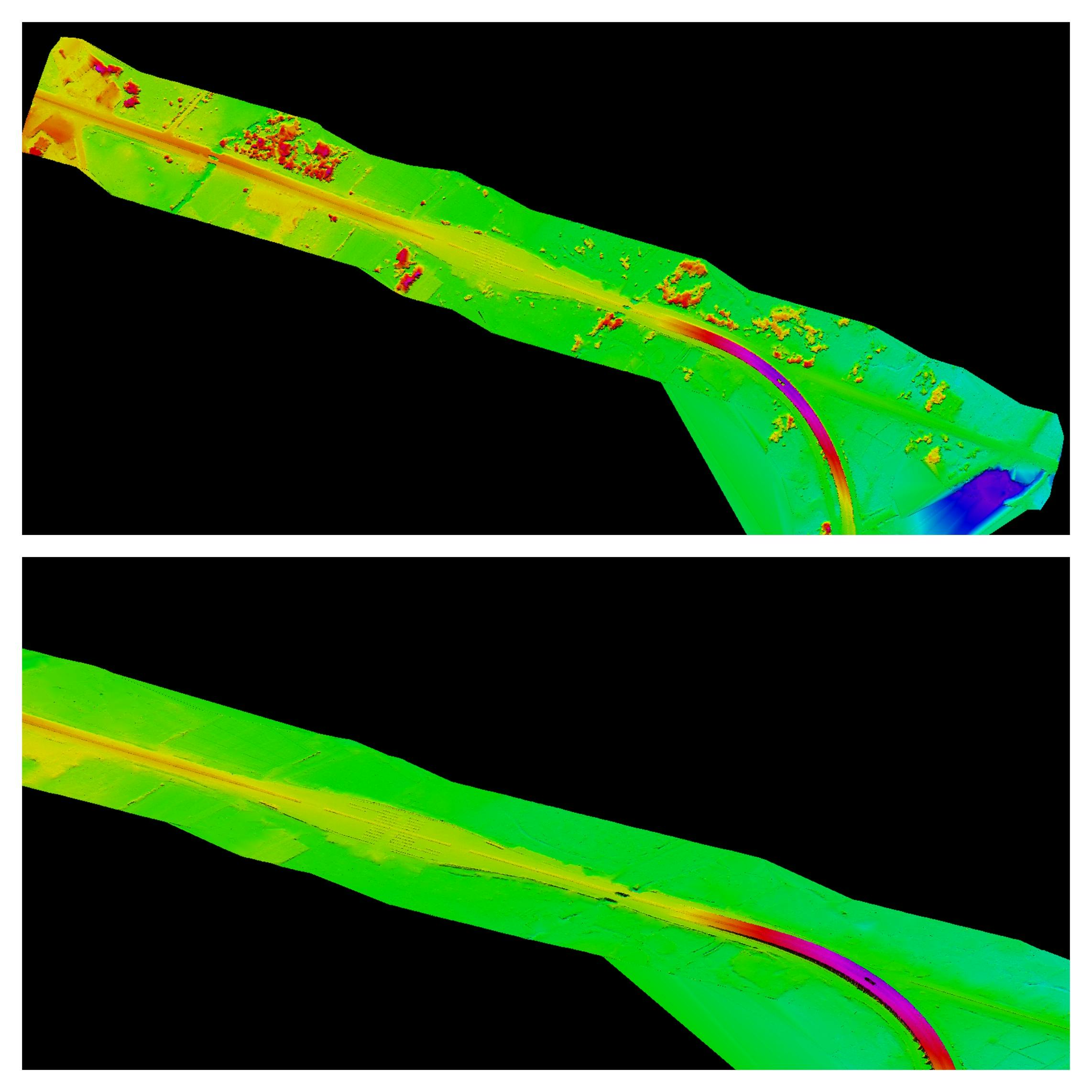
Precision Ground Classification
Geo Zone Technologies excels in ground classification, distinguishing between bare earth and non-ground features. Our advanced classification extends to identifying ground, buildings, roads, powerlines, man-made features, vegetation, water bodies, and more, ensuring comprehensive mapping insights.
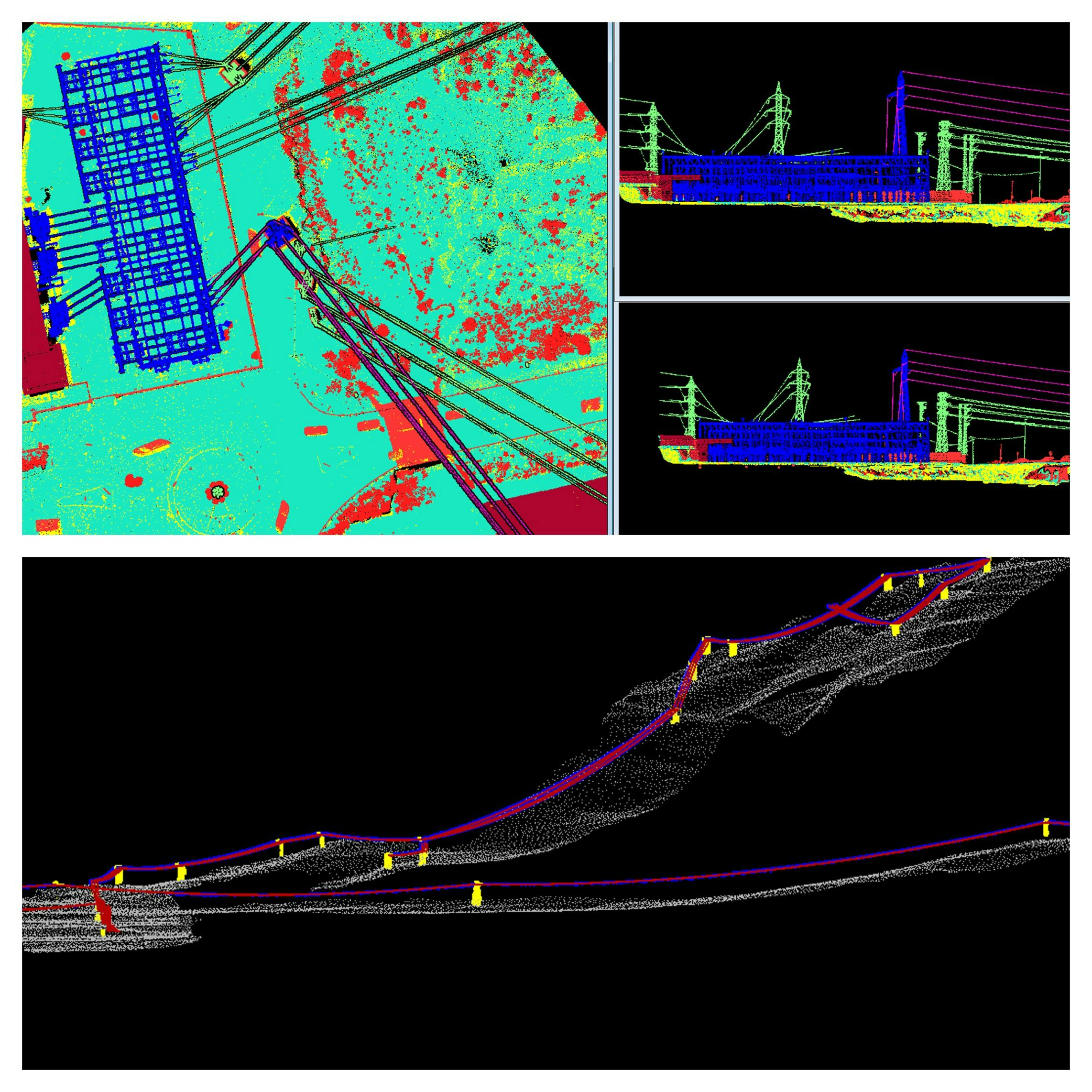
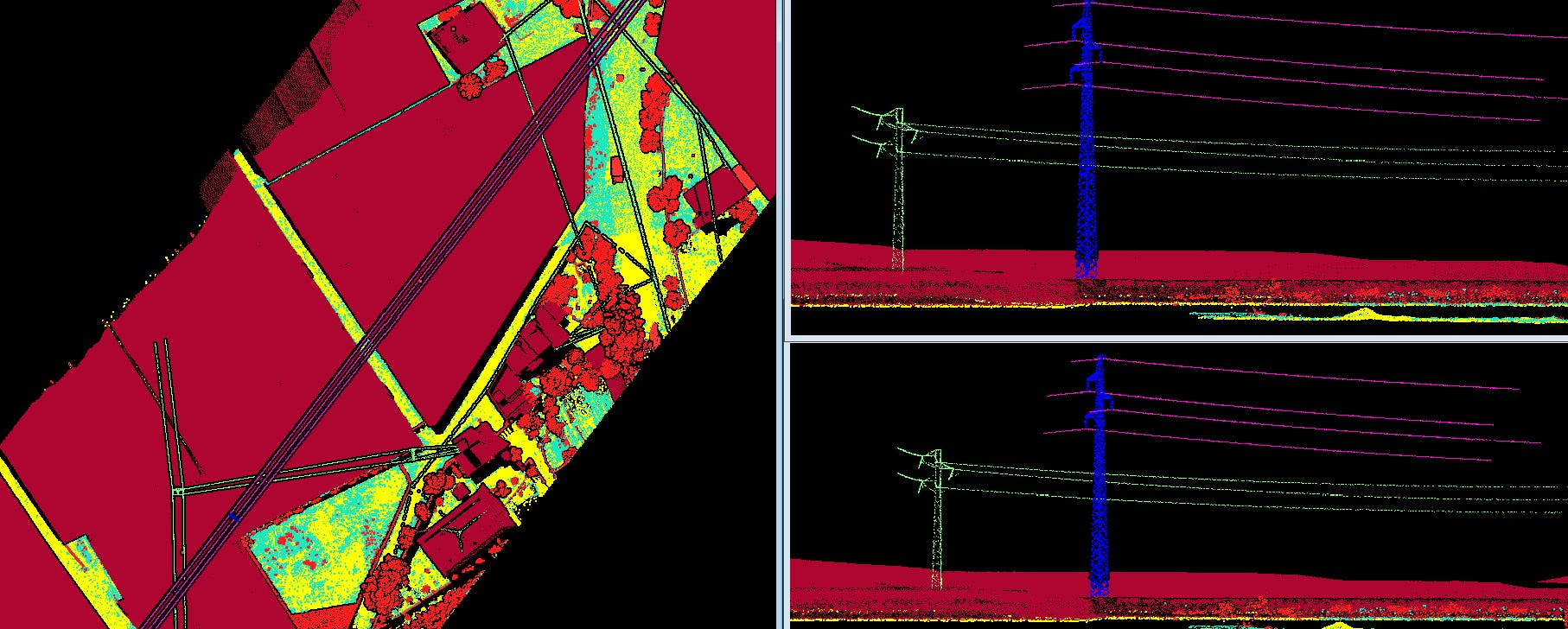
Power Line Expertise and Vectorization
Benefit from specialized power line classification and vectorization services. Geo Zone Technologies is adept at categorizing and vectorizing power lines, ensuring accurate representation and data integration in your mapping projects.
Corridor Mapping and Vectorization
Geo Zone Technologies offers expertise in powerline/corridor classification and vectorization, including powerline stringing. Ensure precise corridor mapping and vectorization for optimized infrastructure planning and maintenance.
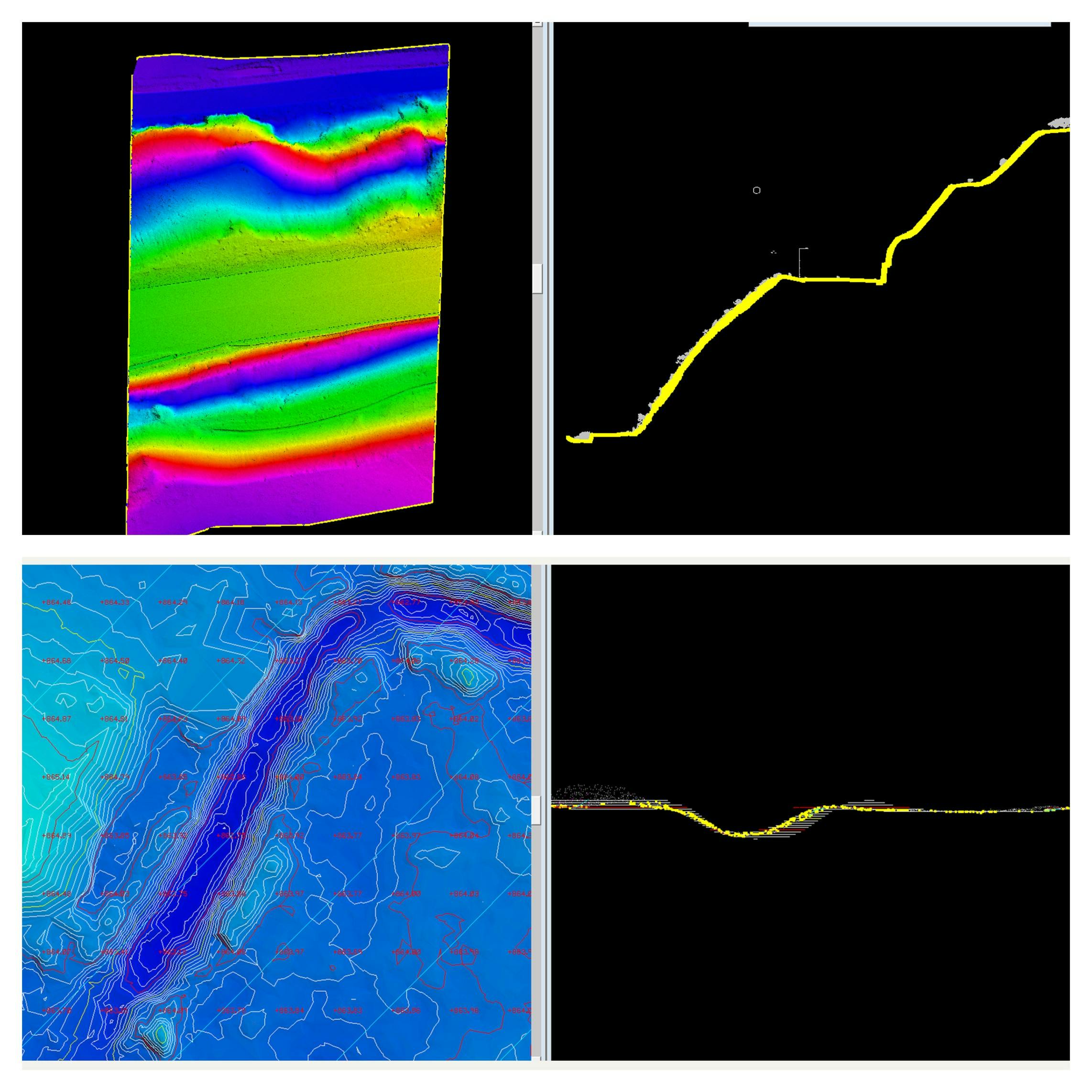
Robust Terrain Modeling and Creation
Experience comprehensive DEM, DTM, DSM, TIN, contour, and spot level data file creation with our mapping services. Geo Zone Technologies ensures meticulous terrain modeling, providing essential data for accurate project planning and analysis.
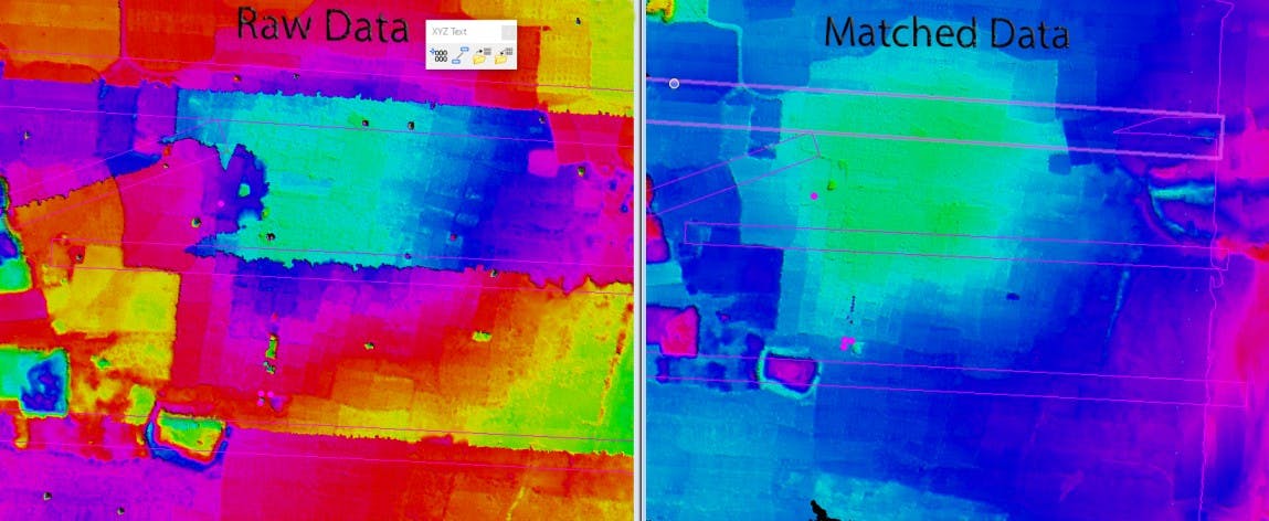
GCP-Driven Point Cloud Matching
Our LiDAR mapping services enable point cloud matching for given GCP (Ground Control Points), ensuring precise alignment and accuracy in spatial representation. Elevate the reliability of your mapping projects through meticulous point cloud matching.
Trajectory-Based Spatial Alignment
Achieve seamless spatial alignment through XYZ matching, flightline, and tieline matching using trajectory files. Geo Zone Technologies ensures cohesive mapping results, optimizing data integration and providing accurate spatial insights.